Monitor Air, Water, and Wildlife with Environmental Drones
Published: 27 Oct 2025
Environmental monitoring drones are revolutionizing how we track and protect the planet. Equipped with high-tech sensors, these drones capture accurate data on air pollution, water quality, and wildlife activity. They allow researchers to survey large areas in a fraction of the time traditional methods require. By providing real-time insights, these drones help in making faster, informed decisions that benefit ecosystems and communities. From monitoring forests to tracking endangered species, the advantages are clear: safer operations, reduced costs, and improved accuracy. With environmental monitoring drones, protecting nature has never been easier or more efficient.
Accurate Air and Water Monitoring
Drones with sensors use advanced sensors to measure air and water quality with precision. They can detect pollutants, chemicals, and particulate matter in real time, even in areas that are hard to reach. By capturing this data quickly, drones provide early warnings of contamination or hazardous conditions. This helps communities and authorities take action faster, prevent damage, and maintain healthier environments. With drones, monitoring air and water becomes safer, more accurate, and far more efficient than traditional methods.
Wildlife and Habitat Tracking
These drones allow researchers to track wildlife and monitor habitats without disturbing animals. Provided with cameras and sensors, drones can observe endangered species from a distance, capturing movement patterns, population numbers, and behavior. This non-invasive approach keeps both animals and researchers safe while providing accurate data. The insights collected help conservationists make better decisions, protect fragile ecosystems, and plan interventions that support long-term wildlife survival.
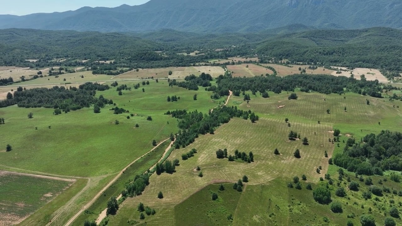
Access to Hard-to-Reach Areas
Specialized drones for ecosystem tracking can reach areas that are difficult or dangerous for humans to access, like dense forests, rugged mountains, and remote lakes or rivers. They fly over these regions to gather detailed data on vegetation, wildlife, and water conditions without putting people at risk. This capability allows researchers to collect more information in less time, covering large areas efficiently. By using these ecosystem-tracking drones, operations become safer, human exposure to hazards is reduced, and data collection is more complete and reliable.
Cost and Resource Efficiency
Ecosystem-tracking drones help cut down manpower and operational costs significantly. Instead of sending large teams into the field, a few operators can manage multiple drones to gather data quickly and efficiently. This reduces expenses while delivering faster results. With lower costs and less effort required, organizations can run more projects, expand monitoring efforts, and make better use of their resources for conservation work.
Real-Time Data for Better Decisions
Drones equipped for ecosystem tracking provide real-time data that helps governments, researchers, and NGOs respond quickly to environmental changes. By receiving live insights on pollution, wildlife activity, or habitat conditions, decision-makers can take timely action to prevent damage or address emerging threats. This immediate access to accurate information supports better environmental policies, faster interventions, and more effective conservation strategies.
Case Studies
Drones have already made a real impact in conservation projects around the world. In forests, drones help detect illegal logging early, allowing authorities to act before major damage occurs. In marine conservation, they track coral reef health and monitor endangered sea turtles without disturbing their habitats. Drones are also used to identify pollution hotspots in rivers and lakes, helping communities clean water faster. These examples show measurable results: faster interventions, healthier ecosystems, and more efficient conservation efforts
Conclusion
Using drones for ecosystem tracking is transforming how we protect the planet. They make monitoring faster, safer, and more accurate while reducing costs and resource use. From tracking wildlife to checking air and water quality, these drones provide real-time insights that support smarter conservation decisions. With this technology, protecting nature becomes easier, more efficient, and more effective than ever.
FAQs
In many ways, yes. They cover large areas faster, cost less, and reduce human risk. Traditional methods often require more people, time, and resources.
Forests, mountains, and remote rivers are no problem for drones. They collect data safely where humans would face risks or delays.
Very accurate. Advanced sensors capture precise readings for air, water, and wildlife. Real-time monitoring helps make better decisions with confidence.