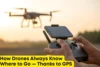
How Drone Position Tracking Keeps Flights Safe
Published: 10 Nov 2025
Most people think flying a drone is all about capturing stunning views, but here’s the twist, what keeps those shots stable and smooth is drone position tracking. This technology doesn’t just guide a drone; it constantly monitors its exact location using GPS, sensors, and real-time data. Whether it’s a delivery drone finding your doorstep or a rescue drone flying in tough weather, position tracking keeps everything precise. It’s the quiet hero behind every perfect flight, making sure drones stay on course, avoid collisions, and perform tasks with flawless accuracy.
How Drone Position Tracking Works
Drone position tracking is the system that keeps a drone aware of where it is and where it needs to go. It combines GPS, sensors, and real-time data to guide every movement with accuracy.
GPS for Location Accuracy : GPS satellites send signals that help the drone find its exact position on Earth. The system measures distance from multiple satellites to calculate coordinates, making it possible for drones to hover, follow routes, or return home safely.
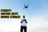
Sensors for Stability and Balance : Inside the drone, sensors like gyroscopes, accelerometers, and barometers constantly measure movement, tilt, and altitude. These sensors help the drone stay steady, even when wind or obstacles try to push it off course.
Real-Time Data Processing : The drone’s onboard computer gathers data from GPS and sensors every second. It processes this information instantly and adjusts the drone’s motors to correct direction or height.
Continuous Feedback Loop : This entire process runs non-stop during flight, creating a feedback loop that keeps the drone stable, accurate, and responsive to its surroundings.
The Role of GPS in Precision Flying
GPS is the core technology that gives drones their sense of direction and precision. It helps them know exactly where they are in the sky and how to stay on track.
Maintaining the Flight Route : GPS allows drones to follow pre-set routes with pinpoint accuracy. The system tracks coordinates in real time, helping drones fly straight paths and reach target locations without drifting off course.
Hovering in One Place : When a drone hovers, it relies on GPS signals to lock its position in the air. Even if there’s wind or minor disturbances, the GPS data helps the drone adjust instantly to stay steady in one spot.
Safe Return-to-Home Function : GPS also makes the return-to-home feature possible. If the drone loses signal or battery power, it automatically uses stored GPS coordinates to navigate back to its takeoff point safely.
Accurate Mapping and Filming : For drones used in photography, surveying, or agriculture, GPS ensures every shot or scan is taken from the right angle and location, keeping results consistent and professional.
Smart Sensors: The Drone’s Eyes and Ears
Sensors are what give drones their awareness and balance. They act like the eyes and ears of the drone, helping it understand motion, direction, and height. Together, they make flight smooth and stable.
Accelerometers for Motion Detection : Accelerometers measure how fast the drone is moving in any direction. When the drone tilts or shifts, the accelerometer senses the change and sends signals to correct its movement, keeping it steady mid-air.
Gyroscopes for Direction Control : Gyroscopes track rotation and help the drone maintain its orientation. They prevent unwanted spins or wobbles, ensuring smooth turns and level flying, especially during sharp maneuvers or wind resistance.
Barometers for Altitude Stability : Barometers read air pressure to calculate altitude. They help the drone stay at a fixed height while hovering or climbing. This keeps the flight consistent, which is vital for tasks like photography, mapping, or delivery.
Real-Time Data and Automated Adjustments
Drones rely on real-time data to make instant decisions while flying. This constant stream of information helps them react quickly to changes in their environment, keeping every flight smooth and safe.
Continuous Data Collection : The drone’s sensors and GPS feed live data about position, speed, altitude, and surroundings. This happens every second, giving the drone a full picture of what’s happening in the air.
Instant Processing and Response : The onboard computer analyzes this data immediately. If strong wind pushes the drone off course, it adjusts motor speed or tilt to stay balanced and on track.
Obstacle Detection and Avoidance : Using cameras or infrared sensors, the drone identifies nearby obstacles and changes its path automatically to prevent collisions—all without pilot input.
Adaptive Flight Control : This nonstop feedback loop helps drones adapt to real-world conditions like sudden gusts, signal drops, or uneven terrain, ensuring steady performance no matter the challenge.
Applications That Rely on Position Tracking
Drone position tracking isn’t just about smooth flying, it’s what makes modern drone operations possible. Many real-world applications depend on this technology to work safely and accurately.
Delivery Drones : Companies use drones to deliver food, medicines, and small packages. Position tracking helps them follow planned routes, avoid restricted zones, and reach your doorstep right on time.
Search-and-Rescue Missions : In emergencies, rescue teams deploy drones to locate missing people in forests, mountains, or disaster zones. Tracking systems allow these drones to move through tough areas, scan locations, and relay GPS coordinates quickly.
Aerial Mapping and Surveying : Drones equipped with cameras and tracking tools map farmlands, construction sites, and cities. Accurate position tracking ensures every image overlaps perfectly, creating detailed maps and 3D models.
Agricultural Monitoring : Farmers use drones to monitor crops, spray fertilizers, and check field health. Tracking keeps the drone flying in straight, even paths to cover every section efficiently.
Why Position Tracking Improves Flight Safety
Position tracking is what keeps a drone safe and steady, even when the skies aren’t perfect. It gives the drone constant awareness of where it is and how it’s moving.
Prevents Crashes and Collisions : By using GPS and obstacle sensors, the drone can detect nearby buildings, trees, or other drones. It automatically adjusts its flight path or speed to avoid impact, reducing the risk of accidents.
Maintains Stable Altitude : With help from barometers and GPS data, the drone holds a steady height during flight. This stability is especially important for filming, surveying, or flying close to uneven terrain.
Ensures Smooth Landings : When it’s time to land, position tracking guides the drone down gently by measuring altitude and adjusting descent speed. It prevents hard landings or tipping over, even on slightly rough surfaces.
Handles Bad Weather Smartly : In windy or low-visibility conditions, real-time data helps the drone stay balanced and on course. It makes tiny flight corrections instantly, keeping the drone safe until it reaches its destination.
Conclusion
Drone position tracking is the quiet force that makes every flight safe, accurate, and reliable. It works behind the scenes, guiding drones through the sky with perfect balance and precision. From holding a steady hover to landing smoothly after a long journey, this technology acts like an unseen pilot—always alert, always in control. Whether it’s a delivery drone, a rescue mission, or a film shoot, position tracking ensures each flight is smooth, efficient, and secure. Without it, drones wouldn’t just lose direction—they’d lose their purpose.