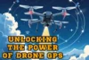
10 Ways GPS Makes Your Drone Safer and Smarter
Published: 23 Jul 2025
The use of GPS in drone flying has made drones smarter, safer, and easier to control. GPS helps your drone hold its position, follow set paths, return home on its own, and stay out of no-fly zones. Whether you are capturing videos, mapping farms, or delivering packages, GPS adds power and precision to every flight. It also plays a big role in search and rescue, flight tracking, and safe landings. Without GPS, drones would just be guessing their way through the sky. In this blog, we will explore the many uses of GPS in drone technology.
1. Holding Position in the Air
One major use of GPS in drone flying is its ability to hold the drone steady in one spot. When GPS is active, the drone locks onto satellite signals to maintain its exact position, even in windy conditions. This feature is perfect for capturing stable photos and videos without sudden movements or drift. It also gives the pilot a break from constantly adjusting the controls.
2. Return to Home (RTH)
This function automatically brings the drone back to its takeoff point if the battery runs low or if it loses signal with the controller. It’s a lifesaver for both beginners and experienced pilots, especially during long flights or in large open areas. You don’t have to worry about losing your drone—it knows how to find its way back. Just remember to set the home point before takeoff so the drone returns to the right location when RTH is activated.
3. Waypoint Navigation
This feature lets you draw a route on a map, and the drone will follow it step by step without manual control. It’s especially helpful in tasks like land surveying, crop monitoring, and mapping large areas. You simply set the points, and the drone flies in a straight, smooth path. This saves time and ensures accuracy.
4. Geofencing for Safety
This feature creates invisible boundaries that stop your drone from flying into restricted areas like airports, military zones, or crowded public spaces. It helps prevent accidents, keeps flights legal, and protects both people and property. Most drones with GPS, like DJI models, come with built-in No-Fly Zone alerts that warn you or even block the drone from entering certain zones. Geofencing is especially helpful for beginners who might not know local rules but still want to fly safely and responsibly.
5. Flight Tracking and Logging
An often overlooked use of GPS in drone flying is flight tracking and logging. GPS records details like the drone’s path, time in the air, and altitude during each flight. This data helps you review your flights, spot any mistakes, and improve your flying skills over time. It’s also useful if something goes wrong, like losing sight of your drone. You can check the flight log to see where it was last located. For beginners and pros alike, flight logs offer peace of mind and a way to grow with each flight.
6. Follow Me Mode
With this feature, the drone locks onto your GPS location and automatically follows you as you move. It’s perfect for vloggers, cyclists, hikers, or anyone who wants hands-free filming while on the go. The drone keeps you in the frame without needing manual control, which makes capturing smooth, action-packed shots much easier. Whether you’re riding a bike through a trail or walking by the beach, Follow Me mode helps you record your adventure effortlessly.
7. Mapping and Surveying
A key use of GPS in drone work is mapping and surveying. GPS helps capture accurate measurements from the air, which is useful in real estate, construction, and farming. Many mapping apps use GPS to plan flight routes and collect precise data quickly.
8. Drone Delivery Routes
GPS allows drones to follow pre-set paths to deliver packages, food, or even medical supplies with precision. Delivery companies use this feature to reach remote areas or avoid traffic delays. The drone knows exactly where to go, reducing the risk of wrong deliveries or delays. With GPS-guided routes, drone deliveries become faster, safer, and more reliable.
9. Search and Rescue Missions
GPS helps guide drones to hard-to-reach areas like forests, mountains, or disaster zones. With real-time tracking, drones can quickly scan wide areas and spot people in need. For example, rescuers have used GPS-enabled drones to find lost hikers by following heat signatures and GPS coordinates. This speeds up rescue efforts and improves safety for both victims and teams.
10: Helping Drones Land Safely
GPS tells the drone exactly where to land, which is especially useful during emergencies or in low-visibility conditions. Whether it’s returning after a long flight or reacting to sudden signal loss, the drone can use GPS data to find its original takeoff spot. This reduces the chance of crashes and helps protect both the drone and anything nearby.
Conclusion
The use of GPS in drone flying brings control, safety, and smart features to every flight. From holding position and following routes to helping in rescue missions and safe landings, GPS plays a big role in how drones work today. If you’re just starting out, choosing a GPS-enabled drone is a smart move. It makes flying easier and more reliable.